
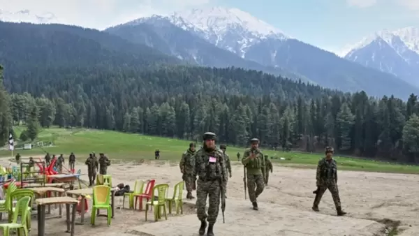








New Delhi: A controversy recently happened involving a U.S.-based satellite image company called Maxar Technologies and a Pakistani firm named Business Systems International (BSI). This came to light after some unusual image requests were made for Pahalgam, a well-known place in Jammu and Kashmir. These requests started increasing in early 2025, just weeks before a terrible terrorist attack took place there on April 22, which killed 26 innocent people.
Between February and March 2025, Maxar received more than a dozen requests for high-resolution satellite photos of the Pahalgam area. The requests were very specific, asking for detailed images of certain spots near where the attack later happened. While most of the orders came from European defense researchers and academic institutions, the timing made Indian intelligence agencies suspicious. There were concerns that the satellite images might have been used by terrorists to plan the attack in the hilly region. Maxar admitted that they provided the images, but said they followed all the legal rules and export laws.
Maxar also had a partnership with a Pakistani company called BSI, which is based in Lahore and owned by a Pakistani-American businessman named Obaidullah Syed. On May 10, 2025, Maxar decided to end its partnership with BSI. This decision came after reports started linking BSI to the Pahalgam image requests, although Maxar said that BSI itself did not request any images related to Pahalgam in 2025. Still, BSI’s reputation was already under question because its owner, Obaidullah Syed, had been convicted in 2022 for illegally sending supercomputers to Pakistan’s nuclear agency (PAEC). Because of this past, people started doubting the company’s reliability.
This incident raised serious concerns about how easy it is to misuse satellite technology. Satellite images are meant for helpful uses like research, weather study, or town planning, but in this case, they may have been used for dangerous reasons. Experts say companies like Maxar need to be more careful about who they work with, especially when it comes to firms from countries involved in conflicts.
The Pahalgam attack also increased the tension between India and Pakistan. Indian officials claimed that Pakistani handlers might have used satellite data to help plan the attack. Even though Maxar says it followed all rules, people are now asking whether the company properly checked the background of its partners, like BSI. The whole situation has shown that international companies must be more responsible when doing business in sensitive regions.
To sum it up, the requests for satellite images of Pahalgam started in February 2025. The terrorist attack happened on April 22. Maxar cut ties with BSI on May 10. This timeline shows how closely events were connected, and it also shows how quickly normal technology can turn dangerous if not handled carefully. This is a reminder for companies and governments to keep a close eye on how satellite data is being used across the world.